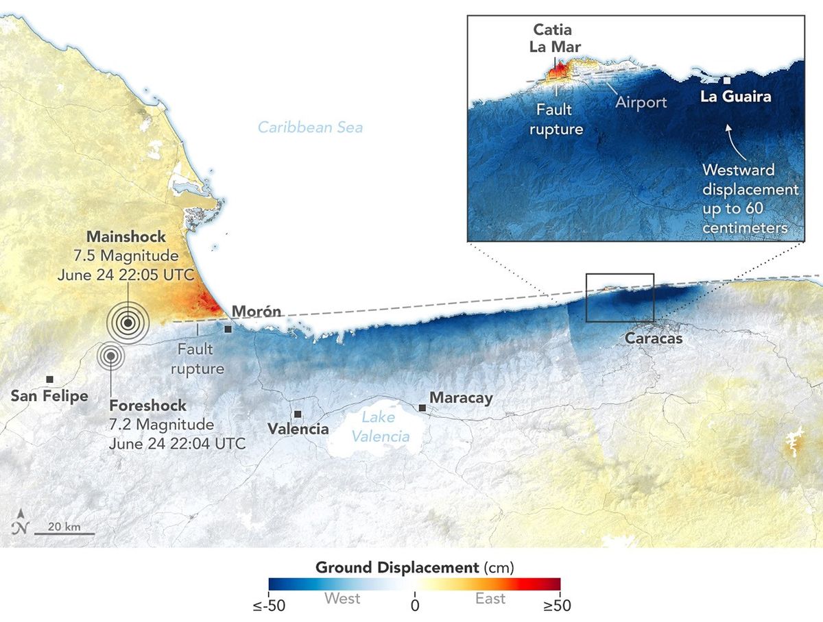
NASA's NISAR satellite captured radar data showing ground displacement in La Guaira, Venezuela, and surrounding areas caused by earthquakes in June 2026. NASA published the findings on July 10, 2026.
The displacement affected La Guaira directly as well as nearby areas, according to NASA. The agency referred to the seismic events as temblors. NISAR's radar instrument was the source of the data used to measure and map the shifts across the affected region.